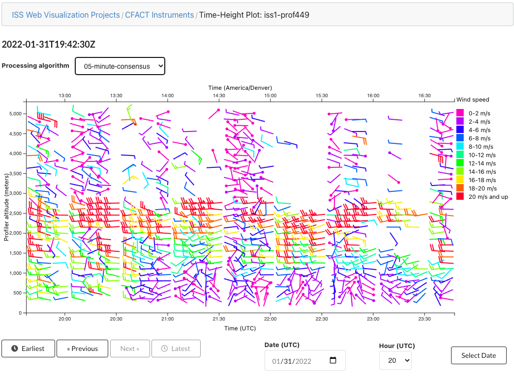
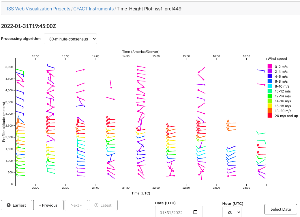
Plots of 05- and 30-minute consensus winds for ISS1 are available in the TimeHeightPlot tool:
- http://datavis.eol.ucar.edu/time-height-plot/CFACT/iss1-prof449/05-minute-consensus
- http://datavis.eol.ucar.edu/time-height-plot/CFACT/iss1-prof449/30-minute-consensus
Data that is available in TimeHeightPlot is:
- Based on the profiler NetCDF files
- Updated with the latest data every half hour as profiler files are synced to Foothills
- Go back to January 3, 2022
Plots of ISS2 LIDAR data are intended to be available as corresponding LIDAR NetCDF files become available.
2 Comments
William Brown
Jan 31, 2022Thanks Eric, it looks good although it's letting through some noisy data (eg, compare the 30-minute with the daily plots). I'm wondering if the SNR threshold might be set a bit low, what is it set to in this code?
Erik Johnson AUTHOR
Feb 01, 2022Hi Bill. I'm not aware of this code doing anything to filter data based on SNR @ the moment. I'll follow up w/ you to discuss this requirement.