On August 30, 2010 I published a scientific paper in the peer-reviewed journal PLoS ONE: Dynamics of Wind Setdown at Suez and the Eastern Nile Delta. The publication attracted international media coverage. The paper cites Google Earth Pro as citation [23]. I used Google Earth imagery to locate ancient river courses, lakes, and coastal lagoons in the eastern Nile delta during the Late Bronze Age (circa 1250 BC). Google Earth overlays provide an accurate way to specify these shorelines in lat-lon coordinates, and from there a Python script modifies the modern topography to reflect the probable Bronze Age geography.
The Google Earth overlays may be downloaded as a KML file from the PLoS ONE article, using the link under Supporting Information to File S1. Figure 1 below shows a screen shot of the overlays. The white outlines represent river courses or the shorelines of bodies of water. 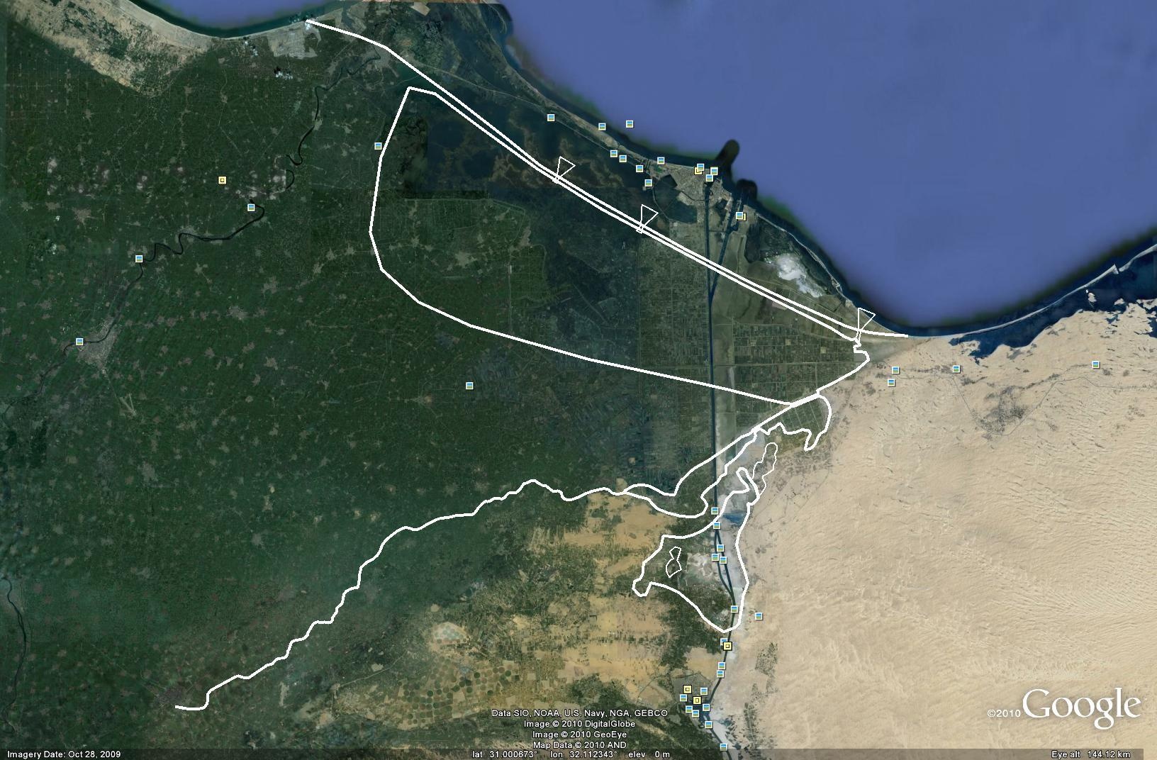
The modified terrain looks like Figure 2 below (originally published as Figure 4 of Drews C, Han W, 2010 Dynamics of Wind Setdown at Suez and the Eastern Nile Delta. PLoS ONE 5(8): e12481. doi:10.1371/journal.pone.0012481): 
Summary: Google Earth Pro is essential to this research for its high-resolution imagery, and as a geo-drawing tool.
Carl Drews
Atmospheric Chemistry Division
NCAR Earth System Laboratory