Synoptic Conditions
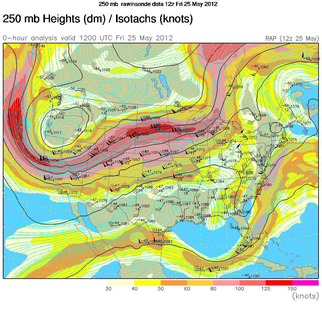
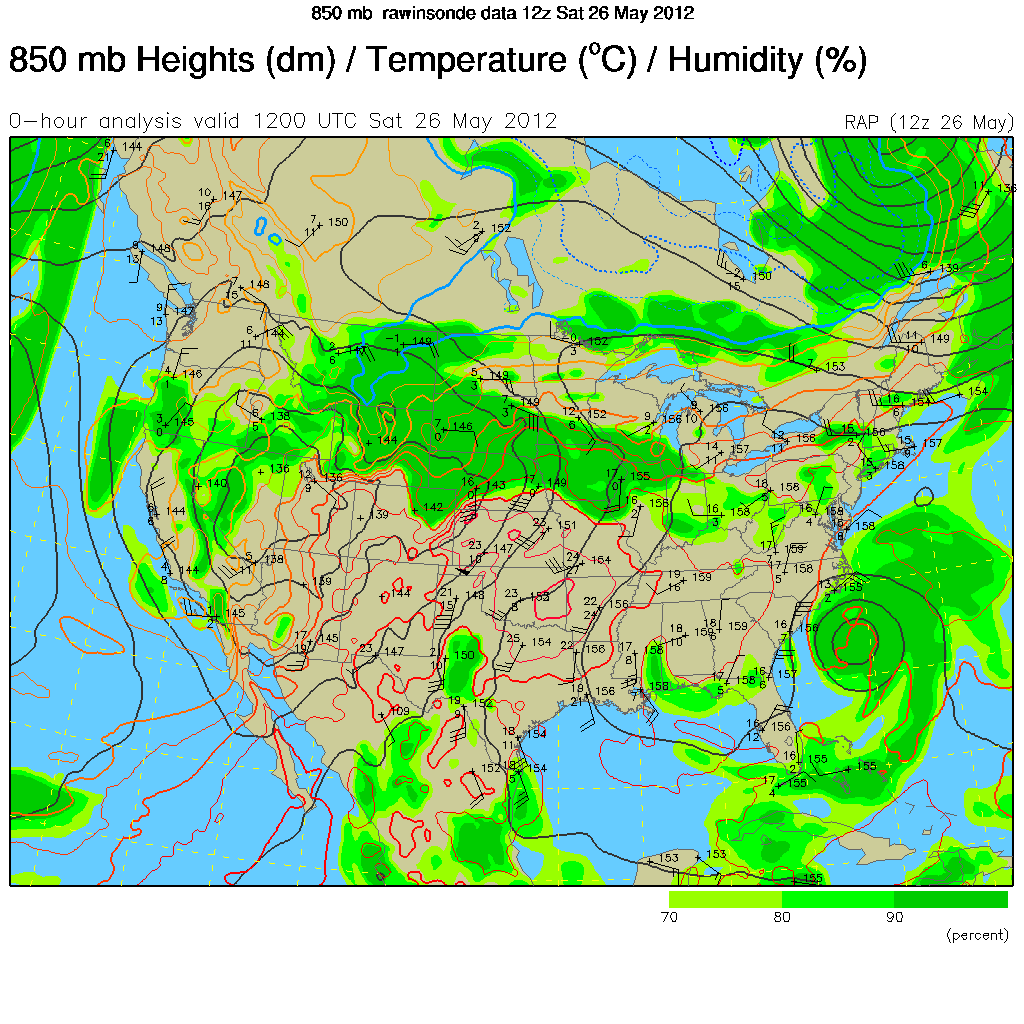
Early in the period the area was under the influence of a weak upper level trough with the subtropical jet located just to the south. The trough was not very pronounced in the lower levels and did not have any associated surface lows. By 26 May, Subtropical Storm Beryl was off the eastern coast of the Carolinas.
Clouds/Precipitation
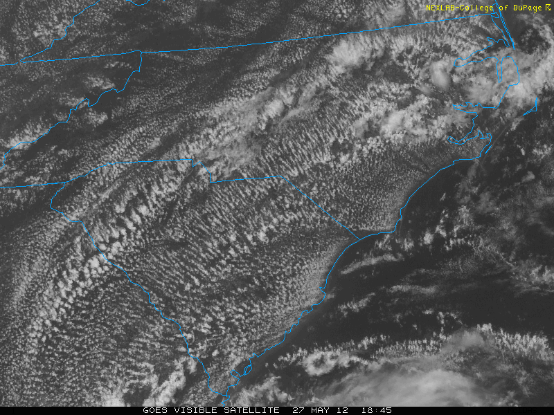
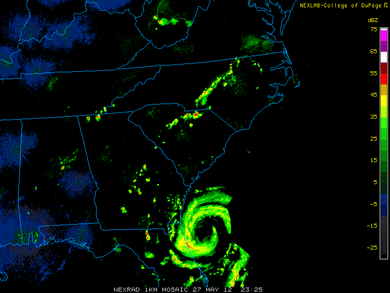
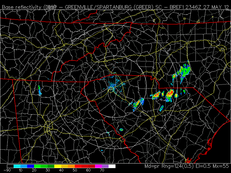
There were a few scattered storms early in the period. On 26 May, rainbands from Beryl began moving onto the coast of North Carolina, but did not reach Charlotte until 27 May. On this day, the center of Beryl was located southeast of the Georgia coast, and a large line of thunderstorms moved into Charlotte from the east around 2330 UTC. The satellite showed mostly scattered cumulus clouds for the daylight portions of the entire period.
Maps/Images
250 mb contour plot at 1200 UTC, 25 May 2012, showing weak upper level trough and subtropical jet
850 mb contour plot at 1200 UTC, 26 May 2012, showing little pronounced features near the surface except for Subtropical Storm Beryl off the east coast of the Carolinas
Base reflectivity at 2325 UTC, 27 May 2012, showing storms associate with rainbands
Base reflectivity at 2346 UTC, 27 May 2012, showing a closer look at storms associated with rainbands
VIS at 1925 UTC, 27 May 2012, showing an example of the cloudiness typical of the summary period