Synoptic Conditions
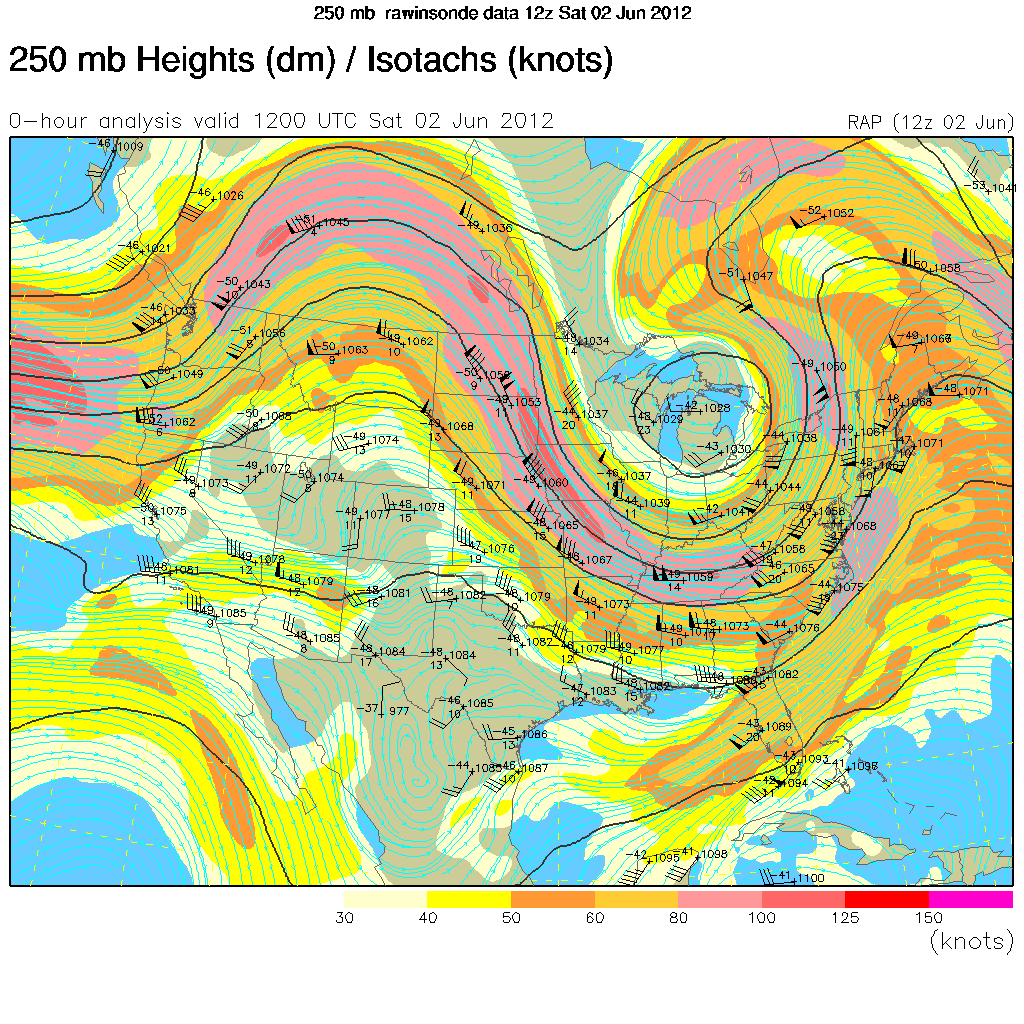
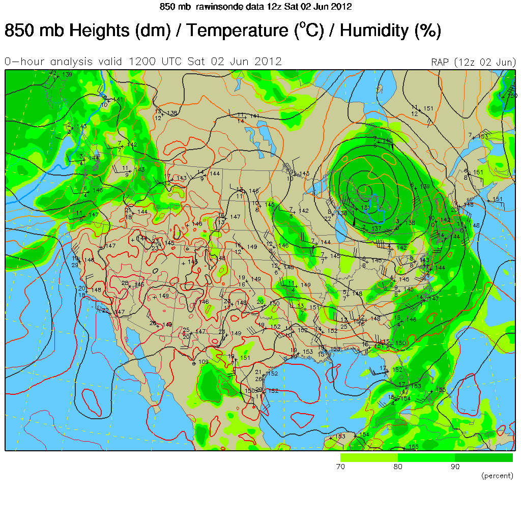
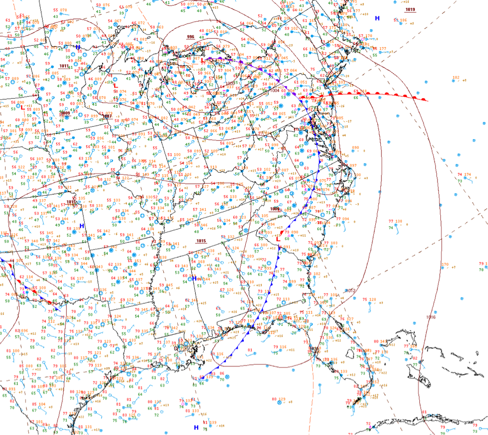
The period begins quietly, but a trough with an upper-level closed low quickly approaches the region as the period progresses, putting Delaware in first the right entrance and the left exist regions of the associated upper-level jet streak. The low pressure is clearly defined through the levels and located north of Delaware as it moved through the Great Lakes region. At the surface, the surface low with occluded front moved through the Ohio Valley. Delaware was first affected by a warm front on 1 June followed rapidly by a cold front early on 2 June.
Clouds/Precipitation
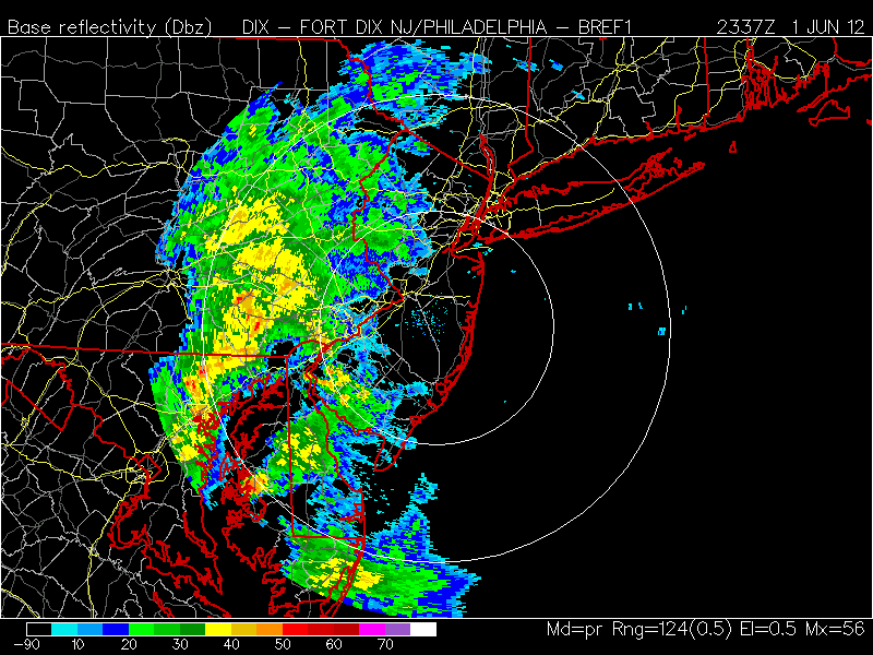
Precipitation began moving into Delaware around 1300 UTC on 1 June. These initial scattered showers and storms were followed by a more solid complex of precipitation after 2200 UTC that continued through 0830 UTC 2 June. The 3 June period was mostly dry until after 2330 UTC, when another round of showers moved in. There were several periods of cumulus and high clouds associated with this system, along with periods of clearing between the rounds of precipitation.
Maps/Images
250 mb contour plot at 1200 UTC, 2 June 2012, showing negatively-tilted upper level trough and closed low
850 mb contour plot at 1200 UTC, 2 June 2012, showing strong closed low over Great Lakes
Surface analysis at 0300 UTC, 2 June 2012, showing frontal systems moving through Delaware
Base reflectivity at 2337 UTC, 1 June 2012, showing precipitation moving through Delaware