Description
This was a clipper type system resulting in a broader band of snow but very intense snowfall rates. I (Phil) was on mids so I woke up around noon and looked outside and could only see 1/4 mi. That rate lasted for 2 or 3 hours in SiouxFalls. This event was fairly well forecast by the operational models, including HiRes WRF and NMM - all predicted a band at least 48 h out. The location was somewhat uncertain. I believe total snowfall was generally 4-7".


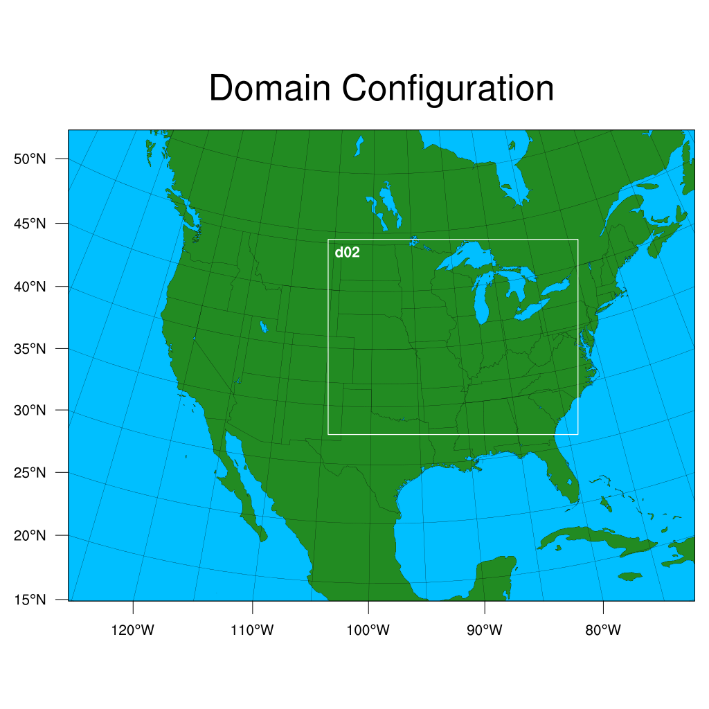
WRF Domain
Initializations to run:
- 20150105 00 UTC
- 20150105 12 UTC
Hourly output out to 48 hours
Data pull
INIT_DATA
- GFS (0.25 degree) - Not available for this date
- GFS (0.5 degree) - pulled, on YS and RAMADDA
- NAM (grid 218)
- HRRR - pulled, on RAMADDA
OBS/RAW/PRECIP_OBS
- CCPA
- MRMS (gcorr, ptype, prate, reflec)
- Gauge-corrected NATIVE: yslogin3:/glade/p/ral/jnt/MMET/OBS/NATIVE/mrms_gcorr
- Precip type NATIVE: yslogin3:/glade/p/ral/jnt/MMET/OBS/NATIVE/mrms_ptype
- Precip rate NATIVE: yslogin3:/glade/p/ral/jnt/MMET/OBS/NATIVE/mrms_prate
- Comp reflectivity NATIVE: yslogin3:/glade/p/ral/jnt/MMET/OBS/NATIVE/mrms_compref
OBS/RAW/RADAR_OBS
OBS/RAW/POINT_OBS
- NDAS prepbufr
- NATIVE: yslogin3:/glade/p/ral/jnt/MMET/OBS/NATIVE/ndas
- Processed: yslogin3:/glade/p/ral/jnt/MMET/OBS/NDAS_03h
- Ran: yslogin3:/glade/p/ral/jnt/MMET/scripts/gen_pb2nc_cmds_3h_ndas.sh and run_pb2nc_cmds_3h_NDAS_all.sh to process native NDAS pb files (run pb2nc and rename appropriately)
- RAP prepbufr:
- NATIVE: yslogin3:/glade/p/ral/jnt/MMET/OBS/NATIVE/rap_pb
- Processed: Do we want to pre-process or run pb2nc in the script?
Data on RAMADDA
- GFS 0.5 degree
- HRRR (additional inits)