Description
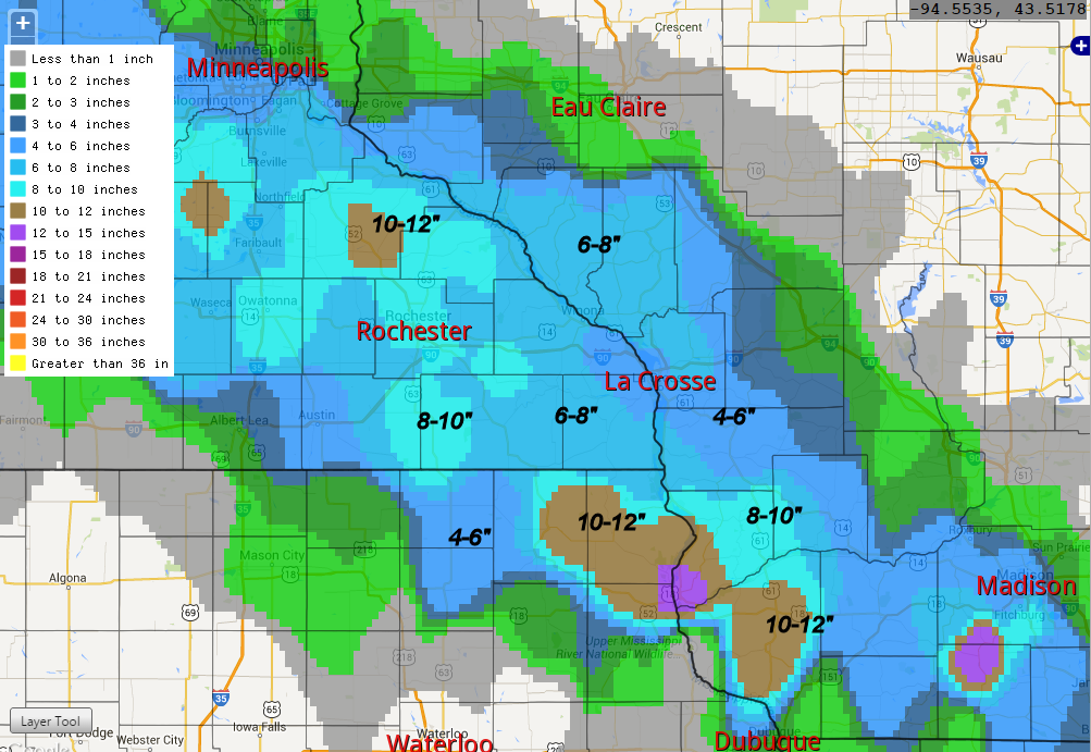
This was a narrow and intense band of heavy snowfall that extended from northeast South Dakota through southern Minnesota (gave MSP 5"), and far southern Wisconsin. Maximum amounts were 10"+ in isolated regions of southeast MN. Temperatures remained near-freezing, which caused much of the precipitation that was forecast to fall as rain, fall as snow instead. This band was not as well forecast days in advance but I recall that there was evidence of banding at least 24 h out in the NMM and/or WRF ARW as well as in a couple of the larger scale models. A window to get HRRR runs would be 06Z 22 March - 06Z 23 March.
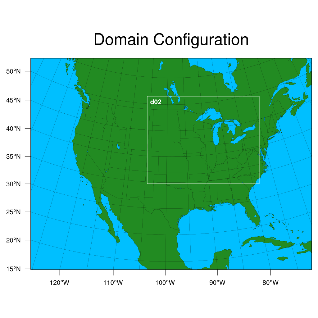
WRF Domain
Initializations to run:
- 20150322 00 UTC
- 20150322 12 UTC?
Hourly output out to 48 hours
Data pull
INIT_DATA
- GFS (0.25 degree) - pulled, on YS and RAMADDA
- NAM (grid 218)
- HRRR - only 2015032212 pulled, on RAMADDA
OBS/RAW/PRECIP_OBS
- MRMS (gcorr, ptype, prate, reflec)
- Gauge-corrected NATIVE: yslogin3:/glade/p/ral/jnt/MMET/OBS/NATIVE/mrms_gcorr
- Precip type NATIVE: yslogin3:/glade/p/ral/jnt/MMET/OBS/NATIVE/mrms_ptype
- Precip rate NATIVE: yslogin3:/glade/p/ral/jnt/MMET/OBS/NATIVE/mrms_prate
- Comp reflectivity NATIVE: yslogin3:/glade/p/ral/jnt/MMET/OBS/NATIVE/mrms_compref
OBS/RAW/RADAR_OBS
OBS/RAW/POINT_OBS
- NDAS prepbufr
- NATIVE: yslogin3:/glade/p/ral/jnt/MMET/OBS/NATIVE/ndas
- Processed: yslogin3:/glade/p/ral/jnt/MMET/OBS/NDAS_03h
- Ran: yslogin3:/glade/p/ral/jnt/MMET/scripts/gen_pb2nc_cmds_3h_ndas.sh and run_pb2nc_cmds_3h_NDAS_all.sh to process native NDAS pb files (run pb2nc and rename appropriately)
- RAP prepbufr
- NATIVE: yslogin3:/glade/p/ral/jnt/MMET/OBS/NATIVE/rap_pb
- Processed: Do we want to pre-process or run pb2nc in the script?
Put relevant data on mandan-> RAMADDA