What Are Science Literacy Maps?
NSDL created Science Literacy Maps as a tool for teachers and students to find NSDL resources that relate to specific science and math concepts. These maps illustrate connections between concepts as well as how concepts build upon one another across grade levels. The Science Literacy Maps are intended to serve as a browsing interface to NSDL resources. Collection builders can align resources to the AAAS benchmark.
How to Use the Maps
|
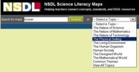
Screenshot of the search and
browse options.
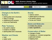
Screenshot of a map list.

Screenshot showing the layout
of a map.
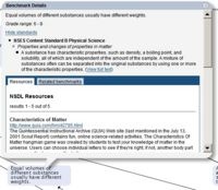
The info bubble contains more
information about a concept.
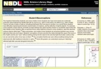
Screenshot showing the student
misconceptions research box.
|
View Maps of Interrelated Science and Math Concepts
- Search for a map by entering a keyword into the search box and clicking the Search button.
- A list of maps containing your keyword will display in the content area.
- CLICK a map name to view the map in the interactive browser.
Or..
- Choose a topic from the drop-down menu to browse maps.
- A list of related maps will display in the content area.
- CLICK a map name to view the map in the interactive browser
Understanding the Layout of the Interactive Browser.
- Grade ranges are listed on the left side of the screen.
- Groups of concepts are listed across the top of the screen.
- Benchmark statements describing each concept appear in the blue boxes.
- The arrows depict how learning progresses as concepts build upon one another.
How to Navigate the Map
There are three ways to navigate around the map space...
- CLICK and DRAG the map with your mouse.
- CLICK and DRAG the red box in mini-map navigation widget located in the lower right corner of the screen.
- CLICK the arrows in the upper right corner of the map.
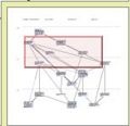
The mini-map navigation widget.
|

The arrow navigation widget. |
View Specific Benchmarks
- CLICK on a blue box to view more information about a specific concept.
- In the new window you can view
- The full benchmark text
- The associated grade level
- Correlations to National Science Education Standards
- The relationship with other benchmarks from all maps.
- NSDL resources that relate to the benchmark.
Find Teaching and Learning Resources
- Within a benchmark's blue box
- If available, CLICK on the Top Picks tab to view highly relevant NSDL resources.
- If available, CLICK on the Related Resources tab to view additional NSDL resources.
- Navigate through pages of resources by clicking the NEXT or PREV links.
- CLICK on the resource title or URL to open the link to that resource in a new window.
View Student Misconception Research (This information is only available for certain maps.)
- Click the View Student Misconceptions link in the upper left corner of the map space to open the box.
- The left column contains the student misconceptions research.
- The right column contains the referenced materials.
- The raised numbers at the end of each sentence corresponds to the reference with the same number in the right column.
- Click the Close Student Misconceptions link in the upper left corner of the map space to close the box.


