Will and I are here for ISFS. Bill, Isabel, and David are here for ISS. Tony and Josh expected in a few hours.
Morning:
- Orientation for everyone
- Added RF4 flag (far end of DTS fiber, though with no offset from the REAL line)
- Created 2-track with turnarounds at the end of the DTS line and the end of the tower line
- Dropped off chem shelter near DTS start
- Dropped off 4 solar panel racks with coolers (so far) along tower line
- Dropped off feet/generator/job box at TT, showed Will how to drive there.
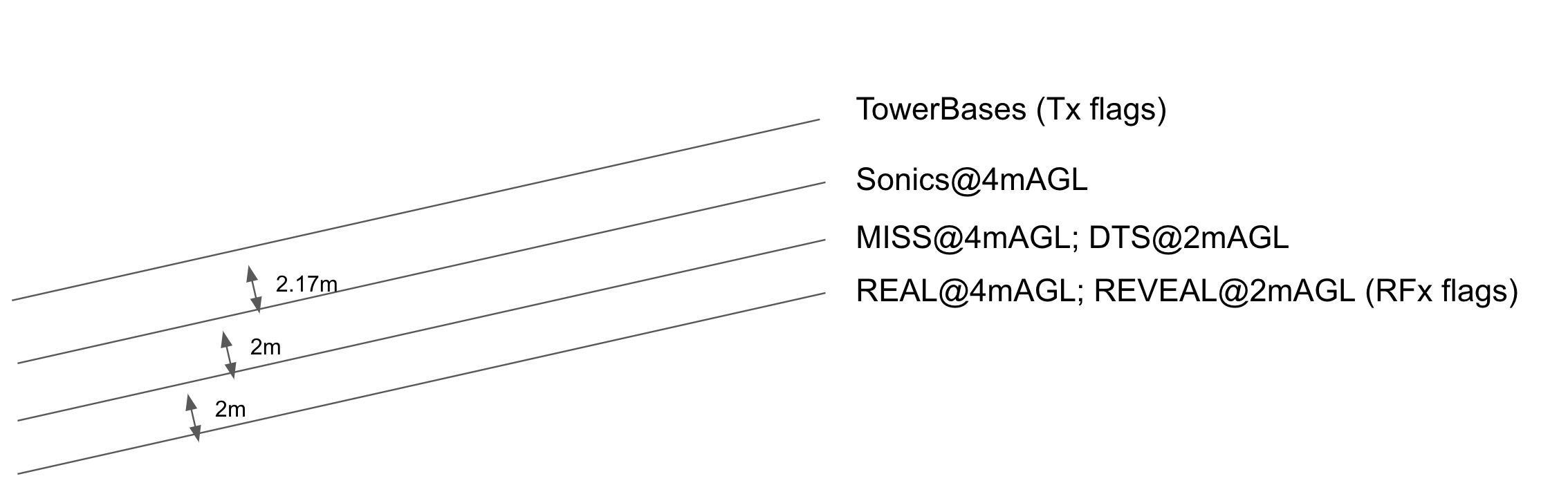
I guess I should explain the layout plan (hopefully the diagram below helps). This is my understanding from various discussions:
- My "reference line" starts with the REAL mirror position, when it is scanning at an azimuth angle 80 degrees and goes out on a bearing of 80 degrees (true). REAL will scan at 4m AGL.
- I think the plan for the REVEAL is to be along the REAL reference line at an altitude of 2m AGL.
- I think the plan for the lidar on top of MISS is to make a parallel scan also at 4m AGL, but offset to the north by 2m.
- The line of sonics is to be also at 4m AGL, but offset an additional 2m (4m north of the REAL reference line. The line of tower base plates are centered 2.17m further to the north (6.17m from the REAL line).
- The line of the DTS fiber is to be parallel at an altitude of 2m AGL, 2m to the north of the REAL reference line.