I note that Google Earth now has an image of the CWEX11 site that shows our paths to the sensors (and thus our locations). This image was taken 9/23/12, so we had left the site (and the nearby fields had been harvested). 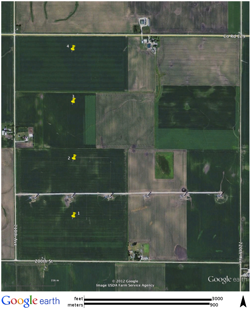
Overview
Content Tools