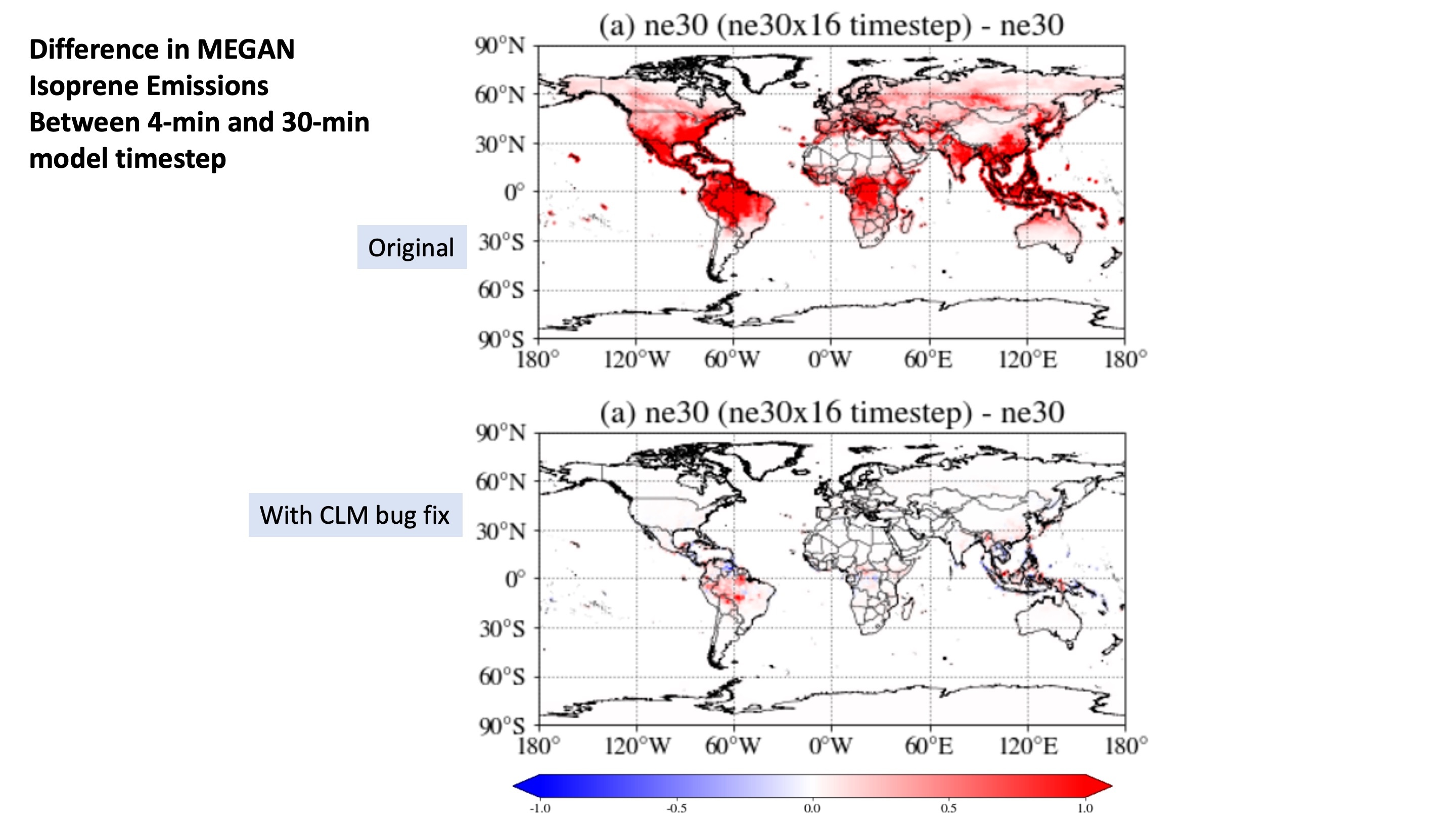
CLM time-averaging bug affecting MEGAN emissions
8 July 2022: A bug has been identified in CLM that probably has affected most MUSICAv0 simulations. This bug results in erroneous calculations of the time-averaged (1-day, 10-days) temperature, photon flux, and other variables, that are used in the MEGAN biogenic emissions calculation (and elsewhere in CLM). See discussion at the CTSM github issue #1789.
In general Isoprene emissions are reduced with bug fix.
Advection error in SE
Spurious vertical transport was found over steep topography. The issue is described in this github issue.
The correction for current development tags is provided in CAM github issue #633.
For CESM2.2.0 source code the correction is, in src/dynamics/se/dycore/prim_advance_mod.F90 (at l.578), replace:
elem(ie)%derived%dpdiss_ave(i,j,k)=elem(ie)%derived%dpdiss_ave(i,j,k)+&
rhypervis_subcycle*eta_ave_w*elem(ie)%state%dp3d(i,j,k,nt)
with:
elem(ie)%derived%dpdiss_ave(i,j,k)=elem(ie)%derived%dpdiss_ave(i,j,k)+&
rhypervis_subcycle*eta_ave_w*(elem(ie)%state%dp3d(i,j,k,nt)-dp3d_ref(i,j,k,ie))
Update Nov 1, 2022: Please see additional code fix described in CAM github issue #678.
Topography file error
Title: Topography file error 2022
Issue: Regional refined topography was in the incorrect location/orientation
Model tags affected: NCAR_Topo_2_0_1 files for regional refinement. An erroneous topography file was specified for use when creating variable resolution grids between April 2022 and Jan 2023.
Model response: Gravity waves impacted, incorrect transport, chemistry fields displaced
Fix: Reprocess topography and re-run model simulations. If you created your own grid during that period please checkout the updated code at: https://GitHub.com/NCAR/Topo and recreate your topography file for your grid and re-run any simulations. To check if your topography file has this error, plot ANGLL vs ANGLX. In a "good" topo-file these variables should have large differences. In a "bad" file they will be very close everywhere.
More information: AMWG development Github issue 213