All "A" DSMs up. C is up as well, just saving data to USB stick. All sensors up. Looking pretty good, but still a bunch of small details to fix.
This really isn't readable, but I wanted to document the sensor status that I just did: sonic trh.0.5m trh.2m baro gps handar power
Aph rs 2 rs 5 rs 6 rs 1 rs G rs 7 ntpq -p rs 8
Ah rs 2 rs 1 rs 5 rs G rs 6 rs 7
Ap rs 2 "mote_dump n,m" rs 1 rs G
A rs 2 "mote_dump n,m" rs G
a1 923 2 9 x x -0.014 12.7
a2 833 14 17 x x -0.007 12.8
a3 743 24 51 x -11.6
a4 1120 x x x -0.005 12.9
a5 732 15 5 x x -0.006 12.9
a6 21 16 x x -0.005 12.9
a7 673 x x x 0 12.8
a8 176 x x 10 x 0 11.9
a9 1121 x x 6 x -0.004 12.7
a10 677 x x 2 x 0.004 12.6
a11 674 x x x 0 13.3
a12 1123 x x 9 x 0.001 12.5
a13 745 x x x -0.001 12.8
a14 1124 x x 5 x -0.005 12.9
a15 1122 x x x -0.001 12.3
a16 740 x x x 0.002 12.3
a17 x x x -0.003 12.7
a18 x -0.002 12.8
a19 672 x x GSx -0.002 12.8
c20
m21 (lower)
m22 (upper)
sonic trh.0.5m trh.2m baro gps handar power
Aph rs 2 rs 5 rs 6 rs 1 rs G rs 7 ntpq -p rs 8
Ah rs 2 rs 1 rs 5 rs G rs 6 rs 7
Ap rs 2 "mote_dump n,m" rs 1 rs G
A rs 2 "mote_dump n,m" rs G
a1 923 2 9 x x -0.014 12.7
a2 833 14 17 x x -0.007 12.8
a3 743 24 51 x -11.6
a4 1120 x x x -0.005 12.9
a5 732 15 5 x x -0.006 12.9
a6 21 16 x x -0.005 12.9
a7 673 x x x 0 12.8
a8 176 x x 10 x 0 11.9
a9 1121 x x 6 x -0.004 12.7
a10 677 x x 2 x 0.004 12.6
a11 674 x x x 0 13.3
a12 1123 x x 9 x 0.001 12.5
a13 745 x x x -0.001 12.8
a14 1124 x x 5 x -0.005 12.9
a15 1122 x x x -0.001 12.3
a16 740 x x x 0.002 12.3
a17 x x x -0.003 12.7
a18 x -0.002 12.8
a19 672 x x GSx -0.002 12.8
c20
m21 (lower)
m22 (upper)
Gordon, Sep 20, 9pm
After some hacking, bluetooth networking is working well.
Initially tried the bluetooth access points on a metal pole mounted on the NW corner of the base trailer. All three radios were on the same pole.
BTAP2, serving sites 8-13 was placed highest on the pole, since we felt it had the worst line-of-site view of its stations. BTAP1, serving sites 1-7, and the AP3, the Bluegiga 3241, serving 14-19 were lower.
We were only able to connect to sites 1,8,13,14,15 and 17.
Later found two issues that might have prevented good connections:
- a bug (mine) in the blue_check.sh script on the DSMs, where it did not restart the pand process if ping failed
- some of the dipole antennas on the radios were not screwed on tightly. I didn't note which stations.
Those 6 sites had pretty good LOS. However other sites which also had good LOS did not come in, which may have been due to the above 2 issues. The dorm buildings were in the way of line-of-site to 5,6,7,9,10,11,12. None of these sites with poor LOS were received.
The WIFI AP24 was also mounted lower on the same pole, and was transmitting, successfully connecting to the ISS-SODAR Etherant EantH.
After lunch, moved the bluetooth radios over to the deck on the back of dorm #2, which has good LOS to all sites. The pole was just bungied to the step railing. AP3 was at the level of the railing, AP1 about a foot above that,
and AP2 about 3 feet above the railing.
Lo-and-behold, only the same connections came in (1,8,13,14,15 and 17), but, initially at least, no others.
Went out to site 4 and discovered the issue with the blue_check.sh script. However, then noticed that several stations started connecting by themselves, despite the bug in the script. So I believe the communications are better from the dorm deck than from the pole on the trailer. To work from the trailer, I believe the radios would have to be raised.
Also at this time noticed that the bluetooth antennas were loose and needed to be screwed on tighter at three sites, but forgot what sites.
The bluetooth connections have stayed up since 5pm this afternoon.
The bluetooth access points are on the pole strapped to the deck stairs. The AP24 WIFI is running, leaning against the deck railing fence. The stations are all sending their data via UDP to the flux laptop (192.168.0.12). The DSMs at main and C are not on.
Here are some connection quality numbers. All bluetooth MAC addresses (aka bdaddr) start with 00:07:80:4f.
For BTAP1 and BTAP2 access points connected to the "flux" laptop (via 2 bluetooth extension cords leading to one powered hub!) I've created a script query_radios.sh, which runs hcitool on the corresponding radio based on its hci device name (hci0 or hci1), querying the radios with rssi, lq (link quality), tp (transmit power) and afh (adaptive frequency hopping).
tp was 19 on all stations (1-13) served by BTAP1 and 2. AFH was typically something like 0xff00f03f00ff03f0ff7f. I believe perhaps that bit of 1 indicates a good channel.
site |
bdaddr |
RSSI |
LQ |
|---|---|---|---|
1 |
d4:f1 |
-7 |
141 |
2 |
d4:ef |
-7 |
209 |
3 |
d4:ee |
-1 |
209 |
4 |
d4:f7 |
-2 |
209 |
5 |
d4:d9 |
-2 |
209 |
6 |
d4:f8 |
-4 |
207 |
7 |
d4:eb |
-2 |
212 |
8 |
d4:e4 |
-6 |
210 |
9 |
d4:ed |
0 |
212 |
10 |
d4:e9 |
-3 |
211 |
11 |
d4:fb |
-6 |
191 |
12 |
d4:e7 |
-2 |
211 |
13 |
d4:f6 |
-5 |
186 |
To see the RSSI (received signal strength indicator) and BER (bit error rate) on the Bluegiga AP3241, ssh to root@192.168.0.13, and run the inq comand:
site |
bdaddr |
RSSI |
BER |
|---|---|---|---|
14 |
d4:fc |
-63 |
0.9 |
15 |
d4:f2 |
-62 |
0.34 |
16 |
d4:f5 |
-62 |
0.34 |
17 |
d4:f0 |
-69 |
0.82 |
18 |
d5:00 |
-67 |
0.74 |
19 |
d4:ff |
-76 |
2.26 |
Note that RSSI is a relative number, and can't be compared between the two types of access points.
On site: Chris, Kurt, Jesse, Steve O. (Gordon showed up at end of day)
All towers now instrumented except:
- 3? A stations that need CSATs brought by Gordon
- 2 TRH + 1 Handar at tower C need to be mounted
- pressure port on (new) A8 is not at the correct height
- Still need to mount radiometers
AC power now goes to both transformers.
Tomorrow we will:
- distribute DSMs
- construct network
- connect systems to AC
- ISS will deploy the SODAR-RASS

September 18, 2012
All Day
Jesse and I tried to finish what we could on the Main Tower and got shutdown due to booms needed and brackets. Kurt showed up and we started to dress all the A-Towers starting from the East. We did not dress all of the C-Tower due to questions for a scientist on what boom they would prefer for the upper pressure port.
These are the numbers we went off of on all A-Towers.
Lower TRH - 84cm to top of boom to edge of base plate.
CSAT - 91.2cm top of boom to base plate but 92cm to top of boom to edge of base plate.
Upper TRH - 2.36cm to top of boom to edge of base plate.
We did all the East towers to the transect line, just West of the Main tower. The Main Tower did NOT get dressed. Questions for a scientist was needed.
Used the ATV today. GREAT help. Trailer did well and easy to get instruments that were stashed at Main Tower to the rest of the towers. We have been locking the ATV w/ trailer to the Base Trailer at nights. Key is in the base trailer by front door.
Tensions are in foot/pounds (ft/lbs) and from inner to outer.
Date |
9/13/2012 |
10/9 |
10/18 |
10/21 |
10/28 |
|
|
|
|
|---|---|---|---|---|---|---|---|---|---|
Northwest |
290 |
130 |
380 |
270 |
250 |
|
|
|
|
|
400 |
220 |
375 |
350 |
400 |
|
|
|
|
|
390 |
280 |
420 |
440 |
400 |
|
|
|
|
South |
290 |
80 |
300 |
250 |
240 |
|
|
|
|
|
350 |
330 |
375 |
375 |
390 |
|
|
|
|
|
420 |
250 |
360 |
450 |
400 |
|
|
|
|
Northeast |
300 |
90 |
325 |
275 |
270 |
|
|
|
|
|
350 |
280 |
425 |
410 |
350 |
|
|
|
|
|
430 |
280 |
375 |
420 |
420 |
|
|
|
|
September 17, 2012
Afternoon - Early Evening
Chris and Jesse on site.
Began to dress the Main Tower this afternoon. Set the Rohn clamps at 20,10,5,4,3,2,1 and 0.5m. Hung instruments on upper three heights.
20.5m: 0741, B4 (this cable was marked with flagging and a BUNCH of knots.
10.00m: 1119, 1393 (this cable was marked with just flagging tied to coiled cable.
5.01m: 0538, B5 (no cables hung on this level).
4.05m:
3.03m:
2.0m:
1.04m:
0.50m:
The ATV was unloaded and locked underneath the Base Trailer. The ramps were also locked to trailer.
The fence stairs have been secured and stable. A LOT better than first week of set-up.
Friday with Kurt, Chris, Jesse, SteveO, John. Started about 0830, worked through until 1500 to give enough time to return the rental truck.
Drove second truckload into the field with all sensors. Fairly quickly discovered that the U-bolts we intended to use to mount all A-tower booms didn't have the back "strap" and thus couldn't be used. Placed an order for more, but they won't be here until at least Monday. So, in the meantime:
- Put TRHs at each site with their appropriate booms. They are simply strapped on the tower with cable ties for the weekend.
- Handars also placed but only strapped
- Installed sonic clamps/booms/arrays at the C tower and all A towers that had clamps (4? sites)
- Left a cache at the main tower of all remaining sonics/kryptons/licors/barometers
- Left stuff for one barometer at the C tower.
- Moved A17 into position
- Staked all solar panels
- Spooled out some of the AC cable from the C transformer
- Wired solar panels at A18 and A19
So, remaining tasks are:
- Spool out remaining AC cable (now at base trailer) to tower C
- Wire solar panels at A1, A4?, A17, A15? when we get cable
- Add all sensors to M tower
- Mount TRHs the correct way at all A towers
- Mount sonics on most A towers
- Mount all barometers
- Possibly move all battery boxes to solar panels (allows the DSMs to be moved high on the towers)
Setup Day 3
Lots of people and stuff. Started about 8:30, lunch break 12:00-2:00; Ended at 5:00
(Chris, Kurt, Rudy, Jesse, Steve O, Steve S, John, Mike D visited)
By lunch time:
- TP01 reinstalled in grass soil site
- all solar panel stands (except for 2 still in base trailer) positioned (still not staked)
- main tower up to 50' with permanet guys
- base trailer delivered, leveled, porch&steps set up
After lunch:
- main tower completed
- base powered up
- rental truck loaded with sensors, etc. for second run (tomorrow)
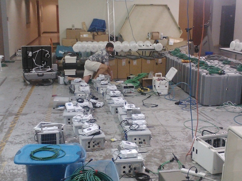
- Gordon/Andrew got networking working in lab; plan is to install data systems on Monday.
Tomorrow is sensor day!
(Entered on Friday for Thursday, since internet at the RIC was down.)
Lots of people and stuff. Started about 8:30, lunch break 12:00-2:00; Ended at 5:00
(Chris, Kurt, Rudy, Jesse, Steve O, Steve S, John, Mike D visited)
By lunch time:
- TP01 reinstalled in grass soil site
- all solar panel stands (except for 2 still in base trailer) positioned (still not staked)
- main tower up to 50' with permanet guys
- base trailer delivered, leveled, porch&steps set up
After lunch:
- main tower completed
- base powered up
- rental truck loaded with sensors, etc. for second run(tomorrow)
- Gordon/Andrew got networking working in lab; plan is to install data systems on Monday.
Tomorrow is sensor day!
Today was a late start due to rain -- we started work about noon and ended about 5PM so that Kurt could run into town for misc. hardware. Nevertheless, in these 5 hours we erected all but one of the A towers (since A17's parts couldn't be moved up the gully due to wet ground), the C tower, and the first 3 (of 7 total) sections of the main tower. We also placed the rad stand. So...only 5 more tower sections to go!
We started the day by noticing a diamondback rattlesnake (Kurt estimated 5' long) coiled up near tower C. The poor thing was cold and tightly coiled. Chris downloaded a photo. We all watched our steps much more closely after that!
Weather is expected to be good into the weekend. We expect the base trailer to arrive tomorrow morning.
P.S. I've put a few photos in this Wiki, but added more to the bottom of the SCP WWW page: http://www.eol.ucar.edu/deployment/field-deployments/field-projects/scp/shallow-cold-pool-scp-field-project
Chris located the "bottomland" set of soil sensors about 8m west of where I had been looking. We'll still have to reinstall the TP01.
This from Jielun using her hand-held GPS yesterday:
Larry and Steve,
Here are my GPS readings. Somehow, I didn't get A8 and A9 right, so you can ignore their numbers. I also plotted all the locations. They look pretty good. The red M is the main tower, the green C is the C tower, and the blue line is the fiber-optic line.
Jielun
Comment by Gordon, Dec 18, 2013: Jielun used the original station numbering, which was revised once the stations were set up. I've added a column to her table indicating the actual station numbering when it differs from hers. I've also substituted a lat,lon for her station a8, actual a9, averaged from the GPS data on the DSM.
lat_a1=40.81149;lon_a1=-104.78518;
lat_a2=40.81007;lon_a2=-104.78242;
lat_a3=40.80813;lon_a3=-104.78271;
lat_a4=40.80949;lon_a4=-104.78023;
lat_a5=40.80876;lon_a5=-104.78040;
lat_a6=40.80816;lon_a6=-104.78053;
lat_a7=40.80763;lon_a7=-104.78076;
lat_a8=40.80772;lon_a8=-104.77811; actual a9: lat 40.80812, lon -104.77788
lat_a9=40.80771;lon_a9=-104.77811; actual: a10
lat_a10=40.80675;lon_a10=-104.77861; actual a12
lat_a11=40.80645;lon_a11=-104.77876; actual a13
lat_a12=40.80606;lon_a12=-104.77897; actual a14
lat_a13=40.80723;lon_a13=-104.77836; actual a11
lat_a14=40.80733;lon_a14=-104.77655; actual a15
lat_a15=40.80700;lon_a15=-104.77667; actual a16
lat_a16=40.80675;lon_a16=-104.77677; actual a17
lat_a17=40.80740;lon_a17=-104.77901; actual a8
lat_a17_old=40.80689;lon_a17_old=-104.77541; unknown
lat_a18=40.80720;lon_a18=-104.77485;
lat_a19=40.80640;lon_a19=-104.77451;
lat_main=40.80719;lon_main=-104.77811;
lat_c=40.80677;lon_c=-104.77467;
lat_fiber1=40.80705;lon_fiber1=-104.77706;
lat_fiber2=40.80679;lon_fiber2=-104.77708;
lat_fiber3=40.80736;lon_fiber3=-104.77700;
The first day of set-up for SCP went pretty well. Despite PI last-minute adjustments and dead batteries both in the theodolite and in one of the vehicles, by the end of the day almost all infrastructure pieces were in place in the field. Most solar panels were connected to batteries to give them a good charge. One run of AC power cable also was positioned. Exceptions (all minor) are:
- A17 was downloaded at its old location, rather than new (not our fault)
- One charge controller left in a battery box in the base trailer
- Several stations are missing power cables that are still in use in Boulder
- A few booms made it to incorrect locations.
- The rad stand is not exactly placed. Larry and I will try to do it tomorrow, though we've formed a plan in any case.
With moderate rain tonight predicted to last till noon tomorrow, we likely will be slower tomorrow. However, we should get a good start on erecting towers.
One problem is that flagging of one of the soil sites was removed. (I found the bare metal wire of the flag several meters away today.) Also, the TP01 at this site had been removed from the ground and is lying on the surface (though it appears to be in perfect shape). I have spent a lot of time (even at low sun angles this morning) looking for traces in the area (I know to within 7m x 7m), but haven't been sure enough of any location to start digging for the buried cable ends. My current idea is to buy a metal detector! In any case, I'll have to rebury the TP01 after I find its PIC processor.
970-897-2276 (rings to dining room)
Site |
CPU |
Kernel |
BT Address |
Access Point |
ntp |
XML |
Sensor test |
Notes |
Ah1 |
Viper 2 |
2.6.35, Aug 23 |
00:07:80:4F:D4:F1 |
1 |
Y |
Y |
OK |
no power mote |
Ah2 |
Viper 6 |
2.6.35, Aug 23 |
00:07:80:4F:D4:EF |
1 |
Y |
Y |
OK |
no power mote |
Aph3 |
Titan 7 |
2.6.35, Aug 29 |
00:07:80:4F:D4:EE |
1 |
Y |
Y |
OK |
no power mote |
A4 |
Titan 5 |
2.6.35, Aug 29 |
00:07:80:4F:D4:F7 |
1 |
|
Y |
OK |
|
Ah5 |
Viper13 |
2.6.35, Aug 23 |
00:07:80:4F:D4:D9 |
1 |
Y |
Y |
OK |
was "wind" DSM at Marshall |
Ah6 |
Viper 14 |
2.6.35, Aug 23 |
00:07:80:4F:D4:F8 |
1 |
Y |
Y |
OK |
|
Ap7 |
Viper 9 |
2.6.35, Aug 23 |
00:07:80:4F:D4:EB |
1 |
Y |
Y |
OK |
|
Ap8 |
Viper 12 |
2.6.35, Aug 23 |
00:07:80:4F:D4:E4 |
2 |
Y |
Y |
OK |
|
Ap9 |
Viper 1 |
2.6.35, Aug 23 |
00:07:80:4F:D4:ED |
2 |
Y |
Y |
OK |
btmote9 not reporting TRH data, |
A10 |
Titan 11 |
2.6.35, Aug 29 |
00:07:80:4F:D4:E9 |
2 |
Y |
Y |
OK |
|
Ap11 |
Viper 16 |
2.6.35, Aug 23 |
00:07:80:4F:D4:FB |
2 |
|
|
OK |
was "ssoffice" DSM |
Ap12 |
Titan 12 |
2.6.35, Aug 29 |
00:07:80:4F:D4:E7 |
2 |
Y |
Y |
OK |
|
A13 |
Titan 9 |
2.6.35, Aug 29 |
00:07:80:4F:D4:F6 |
2 |
Y |
Y |
OK |
|
A14 |
Titan 16 |
2.6.35, Aug 29 |
00:07:80:4F:D4:FC |
3 |
Y |
Y |
OK |
|
A15 |
Titan 6 |
2.6.35, Aug 29 |
00:07:80:4F:D4:F2 |
3 |
Y |
Y |
OK |
has emerald |
A16 |
Titan 8 |
2.6.35, Aug 29 |
00:07:80:4F:D4:F5 |
3 |
Y |
Y |
OK |
|
A17 |
Titan 14 |
2.6.35, Aug 29 |
00:07:80:4F:D4:F0 |
3 |
Y |
Y |
OK |
|
A18 |
Titan 15 |
2.6.35, Aug 29 |
00:07:80:4F:D5:00 |
3 |
Y |
Y |
OK |
|
A19 |
Titan 13 |
2.6.35, Aug 29 |
00:07:80:4F:D4:FF |
3 |
Y |
Y |
OK |
|
C20 |
Viper |
2.6.35, Aug 23 |
NA |
|
Y |
|
|
|
M21 |
Viper 7 |
2.6.35, Aug 23 |
NA |
|
Y |
|
|
Lower sensors on main tower |
Mu21 |
Viper 11 |
2.6.35, Aug 23 |
NA |
|
|
|
|
Upper sensors on main |